PART ONE
TERRITORIAL DISPUTES
TERRITORIAL DISPUTES
"INVOLVING MALAYSIA"
South China Sea
Territorial disputes in the South China Sea involve six sovereign states within the region, namely the:
- People's Republic of China
- Republic of China (Taiwan)
- Philippines
- Vietnam
- Malaysia
- Brunei

Map of various countries occupying the Spratlys
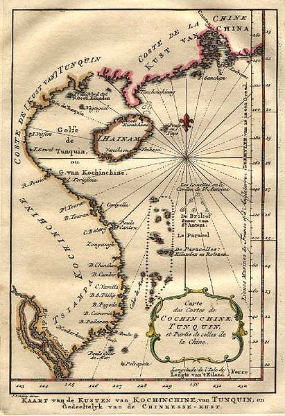
The Spratly and Paracel archipelago are two groups of uninhabited islands located within theSouth China Sea, which are subject to a complex territorial dispute involving the surrounding countries. The interests of different nations include acquiring fishing areas around the two archipelagos, the exploitation of crude oil and natural gas beneath the Spratly Islands, and the strategic control of a core position. Along with territorial land claims on the islets, the disputes also involve the territorial waters of the various countries within the region. The nine-dotted line drawn by China which marks its claim covers around three-fourths of the total area of the South China Sea.
Background

Maritime claims in the South China Sea
Baselines and competing EEZ claims in East and Southeast Asia. Note the amount of overlap in the disputed South China Sea, the Spratlys in particular.
The area is potentially rich in oil deposits. The Ministry of Geological Resources and Mining of the People's Republic of China estimated that the South China Sea may contain 17.7 billion tons of crude (compared to Kuwait with 13 billion tons). In the years following the announcement by the ministry, the claims regarding the South China Sea islands intensified. However, other sources claim that the proven reserve of oil in the South China Sea may only be 7.5 billion barrels, or about 1.1 billion tons. The South China Sea is dubbed by China as the "second Persian Sea". The state-owned China Offshore Exploration Corp. planned to spend 200 billion RMB (US$30 billion) in the next 20 years to exploit oil in the region, with the estimated production of 25 million metric tons of crude oil and natural gas per annum, at a depth of 2000 meters within the next 5 years.
On March 11, 1976, the first Philippine oil company discovered an oil field off Palawan Island (island within the South China Sea belonging to the Philippines). These oil fields supply 15% of annual oil consumption in the Philippines.
However, none of the countries claiming the Spratly Islands have granted concession offshore to avoid provoking a crisis. In addition, since the territorial dispute is not yet resolved, international oil companies have not made commitments.
The abundant fishing opportunities within the region are another motivation for the claim. In 1988, the South China Sea is believed to have accounted for 8% of world fishing catches, a figure that has grown since then. There have been many clashes in the Philippines with foreign fishing vessels (including China) in the Philippine Exclusive Economic Zone. China believes that the value in fishing and oil from the sea has risen to a trillion dollars.
The area is also one of the busiest shipping routes in the world. In the 1980s, at least 270 merchant ships used the route each day. Currently, more than half the tonnage of oil transported by sea passes through it, a figure rising steadily with the growth of Chinese consumption of oil. This traffic is three times greater than that passing through the Suez Canal and five times more than the Panama Canal.
2011 Agreement
On 20 July 2011, the PRC, Brunei, Malaysia, the Philippines, the ROC and Vietnam agreed to a set of preliminary guidelines which would help resolve the dispute. The agreement was described by the PRC's assistant foreign minister, Liu Zhenmin, as "an important milestone document for cooperation among China and ASEAN countries". Some of the early drafts acknowledged aspects such as "marine environmental protection, scientific research, safety of navigation and communication, search and rescue and combating transnational crime", although the issue of oil and natural gas drilling remains unresolved.
Chinese objection to Indian naval presence and oil exploration
On July 22, 2011, the INS Airavat, an Indian amphibious assault vessel on a friendly visit to Vietnam, was reportedly contacted 45 nautical miles from the Vietnamese coast in the disputed South China Sea. The ship was contacted on open radio channel by a party identifying itself as the Chinese Navy and stating that the ship was entering Chinese waters. A spokesperson for the Indian Navy explained that as no ship or aircraft was visible, the INS Airavat proceeded on her onward journey as scheduled. The Indian Navy further clarified that "[t]here was no confrontation involving the INS Airavat. India supports freedom of navigation in international waters, including in the South China Sea, and the right of passage in accordance with accepted principles of international law. These principles should be respected by all.
In September 2011, shortly after China and Vietnam signed an agreement seeking to contain a dispute over the South China Sea, India's state-run explorer, Oil and Natural Gas Corporation (ONGC) said that its overseas investment arm ONGC Videsh Limited had signed a three-year agreement with PetroVietnam for developing long-term cooperation in the oil sector and that it had accepted Vietnam's offer of exploration in certain specified blocks in the South China Sea. In response, Chinese Foreign Ministry spokesperson Jiang Yu, without referring to India by name, stated as follows:
“China enjoys indisputable sovereignty over the South China Sea and the island. China's stand is based on historical facts and international law. China's sovereign rights and positions are formed in the course of history and this position has been held by Chinese Government for long. On the basis of this China is ready to engage in peaceful negotiations and friendly consultations to peacefully solve the disputes over territorial sovereignty and maritime rights so as to positively contribute to peace and tranquillity in the South China Sea area. We hope that the relevant countries respect China's position and refrain from taking unilateral action to complicate and expand the issue. We hope they will respect and support countries in the region to solve the bilateral disputes through bilateral channels. As for oil and gas exploration activities, our consistent position is that we are opposed to any country engaging in oil and gas exploration and development activities in waters under China's jurisdiction. We hope the foreign countries do not get involved in South China Sea dispute”.
An Indian foreign ministry spokesman responded, “The Chinese had concerns, but we are going by what the Vietnamese authorities have told us and [we] have conveyed this to the Chinese.” The Indo-Vietnamese deal was also denounced by the Chinese state-run newspaper Global Times.
Retrenchment
In October 2011, China's Global Times newspaper, published by Communist Party organ People's Daily editorialized on South China Sea territorial disputes under the banner “Don't take peaceful approach for granted”. The article referenced recent incidents involving Philippines and South Korea detaining Chinese fishing boats in the region.
“If these countries don't want to change their ways with China, they will need to prepare for the sounds of cannons. We need to be ready for that, as it may be the only way for the disputes in the sea to be resolved - Global Times (China), 25 October 2011”
Responding to questions about whether this reflected official policy, a Chinese Foreign Ministry spokeswoman stated the country's commitment “to resolving the maritime dispute through peaceful means.
Events
8 January 2005: Chinese maritime police ship open fired at two Vietnamese fishing boats from Thanh Hoa province, killing 9 people.
26 May 2011: The clash involved the Vietnamese Binh Minh 02 oil and gas survey ship and three Chinese maritime patrol vessels occurred 120km (80 miles) off the south-central coast of Vietnam and some 600km south of China's Hainan island. Vietnam says the Chinese boats deliberately cut the survey ship's cables in Vietnamese waters. China denies the allegation. The event stirred up unprecedented anti-China protests in Hanoi and Ho Chi Minh city.
9 June 2011: A Norwegian-flagged seismic conducting ship hired by Vietnam Oil & Gas Corporation (Petro Vietnam) clashed with another three Chinese fishery patrol vessels within Vietnam’s Exclusive Economic Zone. Vietnam once again claimed its exploration cables were deliberately cut.
“China’s systematic action is aimed at turning the undisputed area belonging to Vietnam into an area under dispute in order to materialize China’s nine-dotted line claim in the East Sea. This is unacceptable”.
Spratly Islands Dispute
The Spratly Islands dispute is a territorial dispute over the ownership of the Spratly Islands, a group of islands located in the South China Sea. States staking claims to various islands are:Brunei, China (People's Republic of China), Malaysia, the Philippines, Taiwan (Republic of China), and Vietnam. All except Brunei occupy some of the islands.
The Spratly Islands are important for a number of reasons: the Spratly area holds significant reserves of oil and natural gas, it is a productive area for world fishing and commercial shipping, and coastal countries would get an extended continental shelf. But some states, like China (PRC), Taiwan (ROC), and Vietnam make claims based on historical sovereignty over the islands.
Reasons for the Dispute
Hydrocarbons. There are multiple reasons why the neighboring nations would be interested in the Spratly Islands. In 1968 oil was discovered in the region. The Geology and Mineral Resources Ministry of the People's Republic of China (PRC) has estimated that the Spratly area holds oil and natural gas reserves of 17.7 billion tons (1.60 × 10¹⁰ kg), as compared to the 13 billion tons (1.17 × 10¹⁰ kg) held by Kuwait, placing it as the fourth largest reserve bed in the world. These large reserves assisted in intensifying the situation and propelled the territorial claims of the neighboring countries.
In 1968, the Philippines started to take their claims more seriously and stationed troops on three islands which had been claimed by the adventurer Tomas Cloma as part of Freedomland. In 1973 Vietnamese troops were stationed on five islands.
On 11 March 1976, the first major Philippine oil discovery occurred off the coast of Palawan, within the Spratly Islands territory, and these oil fields now account for fifteen percent of all petroleum consumed in the Philippines. In 1992, the PRC and Vietnam granted oil exploration contracts to U.S. oil companies that covered overlapping areas in the Spratlys. In May 1992, the China National Offshore Oil Corporation (CNOOC) and Crestone Energy (a U.S. company based in Denver, Colorado) signed a cooperation contract for the joint exploration of theWan'an Bei-21 block, a 25,155 km² section of the southwestern South China Sea that includes Spratly Island areas. Part of the Crestone's contract covered Vietnam's blocks 133 and 134, where PetroVietnam, PetroStar Energy (USA) and ConocoPhillips Vietnam Exploration & Production, a unit of ConocoPhillips, agreed to evaluate prospects in April 1992. This led to a confrontation between China and Vietnam, with each demanding that the other cancel its contract.
Commercial fishing. An additional motive is the region's role as one of the world's most productive areas for commercial fishing. In 1988, for example, the South China Sea accounted for eight percent of the total world catch, a figure which has certainly risen. The PRC has predicted that the South China Sea holds combined fishing and oil and gas resources worth one trillion dollars. There have already been numerous clashes between the PRC, the Philippines and other nations over "foreign" fishing vessels in its Exclusive Economic Zone (EEZ) and the media regularly report the arrest of Chinese fishermen. In 1984, Brunei established an exclusive fishing zone encompassing Louisa Reef in the southeastern Spratly Islands.
Commercial shipping. The region is also one of the busiest shipping lanes in the world. During the 1980s, at least two hundred and seventy ships passed through the Spratly Islands region each day, and currently more than half of the world's supertanker traffic, by tonnage, passes through the region's waters every year. Tanker traffic through the South China Sea is over three times greater than through the Suez Canal and five times more than through the Panama Canal; twenty five percent of the world's crude oil passes through the South China Sea.
Confrontations and other Incidences
There have been occasional naval clashes over the Spratly Islands. In 1988, China and Vietnam clashed at sea over possession of Johnson Reef in the Spratlys. Chinese gunboats sank Vietnamese transport ships supporting a landing party of Vietnamese soldiers. 64 Vietnamese soldiers were killed.
On May 23, 2011, Philippine President Benigno Aquino III warned the Chinese defense minister of a possible arms race in the region if tensions worsened over disputes in the South China Sea. Aquino said he told visiting Chinese Defense Minister Liang Guanglie in their meeting that such an arms race could result if there were more encounters in the disputed and potentially oil-rich Spratly islands. The Philippines warned China that it might increase its military capabilities.
Extended Continental Shelf Claims
The United Nations Convention on the Law of the Sea (UNCLOS) procedure for countries with coastlines to submit claims for their continental shelf to be extended beyond 200 nautical miles of their shores brought the spotlight back to the South China Sea and Spratly Islands in May 2009. Two such submissions were made - one by Vietnam for a claim over the northern portion of the sea which included the Paracel Islands, and another jointly by Vietnam and Malaysia for a joint claim over a "defined area" in the middle of the sea between the two countries which included part of the Spratly Islands. Brunei, a potential claimant, has not submitted such a claim but had provided preliminary information to the United Nations notifying it of its intention to claim a continental shelf beyond 200 nautical miles from its shores.
China immediately issued protests over the two submissions and called on the United Nations not to consider them. It also issued a stern warning to countries not to claim the islands which it said were its sovereign territory.
Moves Towards Resolution
Diplomatic Moves
Following a 1995 dispute between China and the Philippines, an ASEAN-brokered agreement was reached between the PRC and ASEAN member nations whereby one country would inform the other of any military movement within the disputed territory and that there would be no further construction. The agreement was promptly violated by China and Malaysia. Claiming storm damage, seven Chinese naval vessels entered the area to repair "fishing shelters" in Panganiban Reef. Malaysia erected a structure on Investigator Shoal and landed at Rizal Reef. In response the Philippines lodged formal protests, demanded the removal of the structures, increased naval patrols in Kalayaan and issued invitations to American politicians to inspect the PRC bases by plane. The Philippine senate also debated to send troops and navy forces to attempt the invasion in the islands.
In the early 21st century, the situation is improving. China recently held talks with ASEAN countries aimed at realizing a proposal for a free trade area between the ten countries involved. China and ASEAN have also been engaged in talks to create a code of conduct aimed at easing tensions in the disputed islands. On 5 March 2002, an agreement was reached, setting forth the desire of the claimant nations to resolve the problem of sovereignty "without further use of force”. In November 2002, a Declaration on the Conduct of Parties in the South China Sea was signed, easing tensions but falling short of a legally binding code of conduct.
Declaration on the Conduct of Parties in the South China Sea 2002
This declaration was signed by the 10 foreign ministers of ASEAN countries and China on 4 November 2002 in Phnom Penh where the signatory countries pledged to resolve their sovereignty disputes in a peaceful manner, without resorting to the use of force and through direct negotiations among the countries concerned. The parties also undertook to exercise self-restraint with activities that would complicate or escalate disputes and affect peace and stability, including refraining from inhabiting on the presently uninhabited islands, reefs, shoals, cays, and other features.
In the interim, the parties pledged to carry out confidence building measures, such as by holding dialogues and exchange of views as appropriate between their defense and military officials; ensuring just and humane treatment of all persons who are in danger or distress; notifying on a voluntary basis other Parties concerned of any impending joint/combined military exercise; and exchanging, on a voluntary basis, relevant information.
The Parties may also explore or undertake cooperative activities such as marine environmental protection; marine scientific research; safety of navigation and communication at sea; search and rescue operation; and combating transnational crime, including but not limited to trafficking in illicit drugs, piracy and armed robbery at sea, and illegal traffic in arms.
United States Intervention
United States Secretary of State Hillary Clinton announced on July 23, 2010 in Vietnam that the U.S. had a "national interest in... respect for international law in the South China Sea" and supported a regional solution to the dispute. This was seen as a victory for Vietnam because Vietnam had been seeking to negotiate the status of the Paracels multilaterally through forums like ASEAN, while China prefers bilateral negotiations. "Small country" claimants such the Philippines were "secretly pleased... to have a friend in court", i.e. the United States, an opinion in the The Manila Times claimed, despite the Philippine Government criticizing the intervention. Chinese foreign minister Yang Jiechi said that Vietnam's invitation to the United States to mediate was "an attack on China".
Various Claims

Map of various countries occupying the Spratly Islands
Brunei
Brunei claims the part of the South China Seas nearest to it as part of its continental shelf andExclusive Economic Zone (EEZ). In 1984, Brunei declared an EEZ encompassing the above-water islets it claims in Louisa Reef. Brunei does not practice military control in the area.
Basis of Brunei's Claim. Brunei's claims to the reef are based on the Law of the Sea. It states that the southern part of the Spratly Chain is actually a part of its continental shelf and therefore a part of its territory and resources.
Malaysia
Malaysia has militarily occupied three islands that it considers to be within its continental shelf. Swallow Reef (Layang Layang) has been turned into an island through land reclamation and hosts a dive resort. The Malaysian military currently occupies Ardasier Reef (Terumbu Ubi), Mariveles Reef (Terumbu Mantanani) and Swallow Reef (Terumbu Layang or Pulau Layang Layang).
Basis of Malaysia's Claim. Malaysia's claims are based upon the continental shelf principle, and have clearly defined coordinates. This argument still requires that the islands were 'resnullius', though.
People's Republic of China and Republic of China (Taiwan)
The People's Republic of China (PRC) claim all of the Spratly Islands as part of China and had a historical naval presence. Recently, they have had a profound military impact on the area.

Map of the South China Sea Islands, by Ministry of the Interior, ROC, 1947.
The Republic of China (ROC), which ruled mainland China before 1949 and has been confined toTaiwan since 1949, also claims all of the Spratly Islands. Today, the People's Liberation Army and the Republic of China Armed Forces are both stationed in several islands, including the largest, Itu Aba aka Taiping Island - occupied by ROC.
From 1932 to 1935, the ROC continued to include the territory in its administrative area through the Map Compilation Committee. When France claimed nine islands of the territory in 1933, it immediately encountered a revolt from Chinese fishermen and a protest from the Republic of China government in Nanking. Although China continued to claim the islands, the Second Sino-Japanese war drew its attention for the meantime from 1937 onwards. After the second world war, China reclaimed sovereignty over the islands through post World War II arrangements based on various treaties of the Allied Powers and China built a stone marker on the island.
In 1947, the ROC government renamed 159 islands in the area and published the Map of the South China Sea Islands. The ROC was the first government to establish a physical presence in the Spratly Islands. It has occupied Itu Aba Island, the largest island in the Spratlys, constantly since 1956.
People's Republic of China
In 1958, the People's Republic of China, having taken over mainland China and having left the Republic of China with control over Taiwan, Penghu, Kinmen, Matsu, and some outlying islands, issued a declaration of a 12 nautical mile limit territorial waters that encompassed the Spratly Islands. North Vietnam's prime minister, Phạm Văn Đồng, sent a formal note to PRC's Premier Zhou Enlai to recognize these claims; and stated that the Government of the Democratic Republic of Vietnam (North Vietnam) respects the decision on the 12 nautical mile limit territorial waters, although South Vietnam continued to claim sovereignty over the islands.
Basis for PRC's and ROC's Claims. The PRC and ROC base their claims on the belief that the islands have been an integral part of China for nearly two thousand years and that neighboring countries and European Powers took advantage of China's poor condition and diversity to impinge on its sovereignty.
China claims to have discovered the islands in the Han Dynasty in 2 BC. The islands were claimed to have been marked on maps compiled during the time of Eastern Han Dynasty and Eastern Wu (one of the Three Kingdoms). Since the Yuan Dynasty in the 12th century, several islands that may be the Spratlys have been labeled as Chinese territory, followed by the Ming Dynasty and the Qing Dynasty from the 13th to 19th Century. In 1755, archaeological surveys the remains of Chinese pottery and coins have been found in the islands and are cited as proof for the PRC claim.
In addition, the PRC's military presence ensures a tangible claim to other potential challengers of sovereignty over at least those inhabited areas.
Criticisms to the PRC's and ROC's claims
Surveying an area without establishing a civilization there or a military garrison does not hold the same political weight as staking an official claim. However, the PRC's claim to the Spratly Islands is grounded in the philosophy that since they were present there first they rightly have sovereignty.
Many of these claims to sovereignty come directly from the Ministry of Foreign Affairs of the People's Republic of China. There is also doubt as to whether these sources state a claim of sovereignty or simply mention the Spratlys alongside other foreign lands.
Claims of pottery being found are mostly shipwrecked treasure from Chinese galleons that sailed through the area and did not necessarily come from anyone who inhabited or even visited the islands.
The Philippines
The Philippines base their claims of sovereignty over the Spratlys on the issues of Res nullius and geography. The Philippines contend their claim was Res nullius as there was no effective sovereignty over the islands until the 1930s when France and then Japan acquired the islands. When Japan renounced their sovereignty over the islands according to the San Francisco Treaty, there was a relinquishment of the right to the islands without any special beneficiary. Therefore, argue the Philippines, the islands became Res nullius and available for annexation.
This is an anachronistic claim however, because the Philippines did not register these claims until the 1970s. In 1956, a private Filipino citizen, Tomas Cloma, unilaterally declared a state on 53 features in the South China Sea, calling it "Freedomland". As the Republic of China moved to occupy the main island in response, Cloma sold his claim to the Philippine government, which annexed (de jure) the islands in 1978, calling them Kalayaan.
The Philippine claim to Kalayaan on a geographical basis can be summarized using the assertion that Kalayaan is distinct from other island groups in the South China Sea, because of the size of the biggest island in the Kalayaan group. A second argument used by the Philippines regarding their geographical claim over the Spratlys is that all the islands claimed by the Philippines lie within its 200-mile Exclusive Economic Zone according to the 1982 United Nations Convention on the Law of the Sea. This argument still requires that the islands were res nullius, though. The Philippines also argue, under maritime law that the People's Republic of China can not extend its baseline claims to the Spratlys because the PRC is not an archipelagic state.
Vietnam
Vietnam's response to China's claim is that Chinese records on Qianli Changsha and Wanli Shitang are in fact records about non-Chinese territories. For example, Qianli Changsha and Wanli Shitang were referred to in the ancient Chinese texts Ling Wai Dai Da and Zhu Fan Zhi as being in the Sea of Jiaozhi, Jiaozhi being the old name for a Chinese province in modern day northern Vietnam (Giao Chỉ), or as writings on foreign countries.
Vietnam's view is that the Chinese records do not constitute the declaration and exercise of sovereignty and that China did not declare sovereignty over the Spratlys until after World War II. On the other hand, Vietnam claims the Spratlys based on international law on declaring and exercising sovereignty.
A western map depicting the islands as Vietnamese territory.
Vietnamese claims that it has occupied the Spratley and the Paracel islands at least since the 17th century, when they were not under the sovereignty of any state, and that they exercised sovereignty over the two archipelagos continuously and peacefully until they were invaded by Chinese armed forces. In Phủ Biên Tạp Lục (Miscellaneous Records of Pacification in the Border Area) by the scholar Lê Quý Đôn, Hoàng Sa (Paracel Islands), and Trường Sa (Spratly Islands) were defined as belonging to Quảng Ngãi District. In Đại Nam Nhất Thống Toàn Đồ (Dai Nam Unified Map), an atlas of Vietnam completed in 1838, Trường Sa was shown as Vietnamese territory. Vietnam had conducted many geographical and resource surveys of the islands. The results of these surveys have been recorded in Vietnamese literature and history published since the 17th century. After the treaty signed with the Nguyễn Dynasty, France represented Vietnam in international affairs and exercised sovereignty over the islands.
The Cairo Declaration, drafted by the Allies and China towards the end of World War II, listed the territories that the Allies intended to strip from Japan and return to China. Despite China being among the authors of the declaration, this list did not include the Spratlys. Vietnam's response to China's claim that the Cairo Declaration somehow recognized the latter's sovereignty over the Spratlys is that this claim has no basis in fact.
At the San Francisco Conference on the peace treaty with Japan, the Soviet Union proposed that the Paracels and Spratlys be recognized as belonging to China. This proposal was rejected by an overwhelming majority of the delegates. On July 7, 1951, Tran Van Huu, head of the Bảo Đại Government's delegation to the conference declared that the Paracels and Spratlys were part of Vietnamese territory. This declaration met with no challenge from the 51 representatives at the conference.
The text of the Treaty of San Francisco listed the Spratlys as not part of the list of territories to be returned to China.
After the French left, the Vietnamese government exercised sovereignty over the islands. Up to the end of the Vietnam War the army of the South Vietnamese still held military control over the majority of the Spratly islands. After theVietnam War, the unified Vietnam SRV (Socialist Republic of Vietnam) continued to claim the Spratly islands as an integral part of Vietnam, accordingly the Phan Van Dong DRV notice to the PRC in 1958 had not ceded the ROV and consequently the SRV claims, hence that Notice became of no effect on the ROV/SRV rights.
Vietnam currently occupies 31 islands. They are organized as a district of Khanh Hoa Province. At the 12th National Assembly Election held early in Trường Sa, the people and soldiers also voted for their local district government for the first time. For the first time, Trường Sa is organized like a normal inland district, with a townlet (thị trấn Trường Sa) and two communes (xã Sinh Tồn, xã Song Tử Tây). Forty nine people were elected to the communes' people's councils.
Occupied features. A feature is occupied by a country if one of the following is true:
- Soldiers and/or civilian citizens of a country are present in the feature, either by building structures over the feature to house the citizens (most features are of this type) or by manning a ship anchored over the feature (Philippine-occupied Irving Reef is of this type).
- Regularly visited by soldiers of a country, not necessarily having soldiers present in it 24 hours. These features must lie near (within 9 miles (14 km)) a feature occupied by the country in the way of the first condition. Presence of structures is not necessary. This is the case of Philippine-occupied Flat Island and Lankiam Cay where soldiers stationed at Nanshan Island and Loaita Island respectively, regularly visit on a daily basis.
- The effective visible distance of horizon from a 15 meter (typical large structure) height above sea-level is 9 miles (14 km). This makes features occupied by the second condition to be also labeled as "occupied" since they can be guarded far away. However not all features within the 9-mile (14 km) radius can be considered as absolutely occupied. This is especially true for features that lie between and within 9 miles (14 km) of two or more features occupied by different countries.
TO BE CONTINUED IN PART 2
No comments:
Post a Comment